The Newport Harbor Hotel and Marina - Pier 49 (Newport, Rhode Island)
USA /
Rhode Island /
Newport /
Newport, Rhode Island /
America's Cup Avenue, 49
World
/ USA
/ Rhode Island
/ Newport
World / United States / Rhode Island
hotel, restaurant, marina
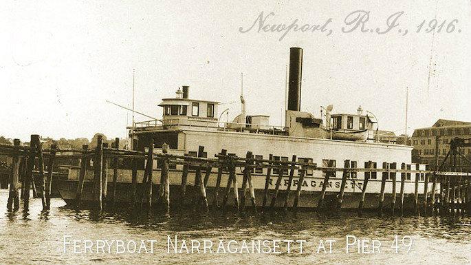
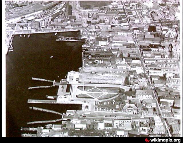
Originally built by the United States Navy, The Newport's Pier 49 location was known as “Government Landing” for over 60 years. This was the Navy’s Newport harbor side dock. Launches would ferry sailors from their ships anchored in the bay, to the torpedo station at Goat Island, the Training Station at Coasters Harbor Island, or to Fort Adams.
The pier also became the home of the Newport-Jamestown Ferry, as there wasn’t a bridge connecting Jamestown and Newport at that time. The torpedo station on Goat Island was phased out, The Newport Bridge was completed in 1969 and the naval fleet departed Newport in the early 1970’s rendering Government Landing obsolete.
www.newporthotel.com/
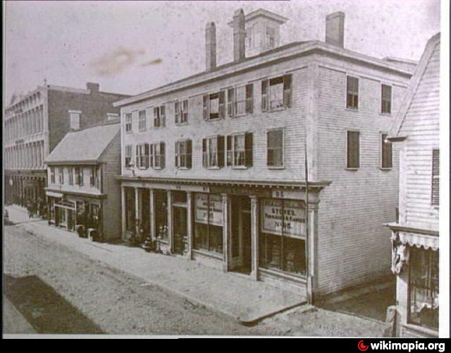
Also the site of the wharf of Aaron Lopez in the mid 1700's, (at the foot of Church St.).
en.wikipedia.org/wiki/Aaron_Lopez
Many old wharves went the way of the excavator here, all filled in in the name of progress and eventually for the creation of America's Cup Avenue, a list of several mapped in 1876 from south to north - Peckham's Wharf, Eng's Wharf (Lopez Wharf), Bull's Wharf, Champlin's Wharf, Swinburne's Wharf, Sherman's Wharf, and Swan's Wharf, among others, shipyards, coal yards and icehouses, slave pens, pirates and privateers... so much American history in this area is almost hard to fathom.
earlier details of this area can be found at www.historicmapworks.com/Overlay/?m=18607&c=US
The pier also became the home of the Newport-Jamestown Ferry, as there wasn’t a bridge connecting Jamestown and Newport at that time. The torpedo station on Goat Island was phased out, The Newport Bridge was completed in 1969 and the naval fleet departed Newport in the early 1970’s rendering Government Landing obsolete.
www.newporthotel.com/
Also the site of the wharf of Aaron Lopez in the mid 1700's, (at the foot of Church St.).
en.wikipedia.org/wiki/Aaron_Lopez
Many old wharves went the way of the excavator here, all filled in in the name of progress and eventually for the creation of America's Cup Avenue, a list of several mapped in 1876 from south to north - Peckham's Wharf, Eng's Wharf (Lopez Wharf), Bull's Wharf, Champlin's Wharf, Swinburne's Wharf, Sherman's Wharf, and Swan's Wharf, among others, shipyards, coal yards and icehouses, slave pens, pirates and privateers... so much American history in this area is almost hard to fathom.
earlier details of this area can be found at www.historicmapworks.com/Overlay/?m=18607&c=US
Nearby cities:
Coordinates: 41°29'15"N 71°18'59"W
- Rose Island 2.5 km
- Shamrock Cliff - OceanCliff 4.3 km
- Bateman-Davis Estate / Bateman's Hotel 4.6 km
- Castle Hill Inn & Resort 4.6 km
- Clarion Providence Seekonk 35 km
- Hilltop Hotel & Conference Center 38 km
- Spring House 41 km
- Atlantic Inn 41 km
- Champlins Resort and Marina 41 km
- Twin River Casino 46 km
- The Brick Marketplace 0.1 km
- Newport Yacht Club 0.2 km
- Newport Yachting Center 0.3 km
- Cardine's Field 0.4 km
- Washington Square 0.4 km
- Newport Gateway Center 0.4 km
- Rhode Island State Pier 9 0.4 km
- Society of Friends 0.6 km
- Newport Shipyard - Fall River Line Wharves 0.6 km
- Newport County, Rhode Island 10 km
Comments