Mother See of Holy Etchmiadzin (Vagharshapat (Etchmiadzin))
Armenia /
Armavir /
Vagharshapat /
Vagharshapat (Etchmiadzin)
World
/ Armenia
/ Armavir
/ Vagharshapat
World / Armenia
monastery, UNESCO World Heritage Site, Armenian Apostolic church
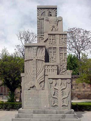
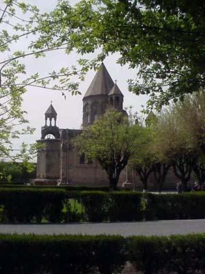
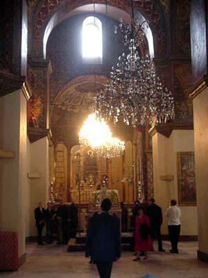
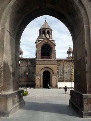
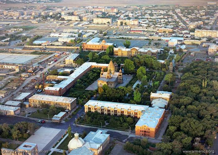
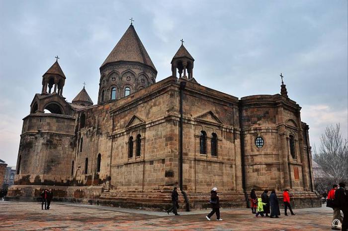
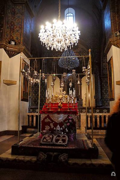
Vagharsh I, from the Royal House of Arshak (Arsacids) once again rebuilt and remodeled the city of Vardkesavan, the city walls were completely rebuilt and restructured. In his honor king Vagharsh I renamed the city Vagharshapat. The vast city of Vagharshapat was considered as a second capital, after the city of Artashat, by the Arshakouni kings. The city of Vagharshapat had the Royal Palace of the Arshakouni kings, the city also had a large military contingent of the kings and nobles army which was housed in barracks of the city. After 301 A.D. and after the establishment of Christianity as a State Religion by St. Gregory the Illuminator, the city of Vagharshapat became the Holy Center of Christian Armenia and for Christians of Armenia, and as well as a safe heaven for the Christians outside of Armenia, of the vast Roman and Persian Empires, where Christianity was still persecuted to a large extent by their pagan rulers. In 303 A.D. the construction of the Mother Church of the Holy See of St. Etchmiadzin was completed. St. Gregory the Illuminator himself became the first patriarch Catholicos of Armenia's Holy Apostolic Church and began the construction of the Great Mother Church and Catholicos seat of Holy Etchmiadzin which in Armenian means "the Holy Ground of Christ's descent". As tradition tells the spot where to begin the construction of mother church was pointed out by Jesus Christ were he himself came down upon from the heaven
www.armenianhighland.com/churches/chronicle431.html
See details about buildings located here at 66.208.37.78/index.jsp?sid=1&id=970&pid=4
Pictures by Armenians.com
armenians.com/Gallery/Echmiatsin/Echmiyadzin/index.html
www.armenianhighland.com/churches/chronicle431.html
See details about buildings located here at 66.208.37.78/index.jsp?sid=1&id=970&pid=4
Pictures by Armenians.com
armenians.com/Gallery/Echmiatsin/Echmiyadzin/index.html
Wikipedia article: http://en.wikipedia.org/wiki/Etchmiadzin_Cathedral
Nearby cities:
Coordinates: 40°9'39"N 44°17'28"E
- Wadi Rum 1414 km
- Mount Athos (Agion Oros) 1720 km
- Ennedi Massif 3354 km
- Manovo-Gounda St. Floris National Park 4118 km
- Garamba National Park 4240 km
- Okapi Wildlife Reserve 4505 km
- Ruwenzori Mountains National Park 4626 km
- Dja Faunal Reserve - UNESCO World Heritage Site 5192 km
- Arli National Park 5290 km
- Pendjari National Park 5311 km
- Nercessian Forest of the Mother See 0.6 km
- Vagharshapat district 2.5 km
- Lake Metsamor 10 km
- Lake Akna 11 km
- Metsamor Nuclear Power Plant 13 km
- Vordan Karmir State Sanctuary 17 km
- Armavir District 21 km
- East Iğdır Plain 22 km
- Ararat valley 24 km
- Iğdır Province 36 km