South Texada Island Provincial Park
Canada /
British Columbia /
Parksville /
World
/ Canada
/ British Columbia
/ Parksville
park
Add category
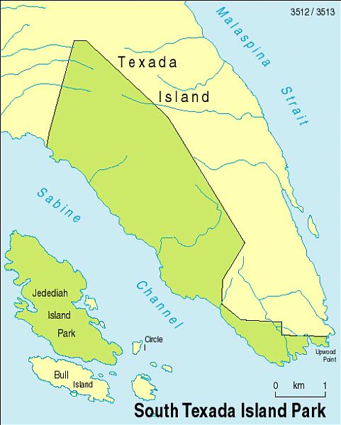
900 Hectares. Black-tailed deer, birds and inter-tidal life can all be found in the park and there are many old roads that are suitable for mountain biking and hiking. The park has opportunities for fishing, kayaking and hiking, but there are no camping facilities or other services provided.
The steep, rocky shoreline of South Texada Park makes access by boat very difficult. However, Anderson Bay Provincial Park, a separate parcel located on South Texada’s eastern shore,. provides well-protected anchorage from all sides except the southeast. The small island and peninsula are included in the park, but the head of the bay is private land.
The steep, rocky shoreline of South Texada Park makes access by boat very difficult. However, Anderson Bay Provincial Park, a separate parcel located on South Texada’s eastern shore,. provides well-protected anchorage from all sides except the southeast. The small island and peninsula are included in the park, but the head of the bay is private land.
Nearby cities:
Coordinates: 49°31'0"N 124°9'57"W
- Clayoquot Plateau Provincial Park 100 km
- Hesquiat Peninsula Provincial Park 174 km
- Schoen Lake Provincial Park 176 km
- Tahsish-Kwois Provincial Park 235 km
- Brooks Peninsula Marine Provincial Park 283 km
- Cape Scott Provincial Park 336 km
- Q'altanaas/Aaltanhash Conservancy 521 km
- Alty Conservancy 595 km
- Anhluut'ukwsim Laxmihl Angwinga'asanskwhl Nisga'a Provincial Park 723 km
- Naikoon Provincial Park 753 km
- Anderson Bay 2.3 km
- Rabbit Island 3.8 km
- Paul Island 4.1 km
- Lasqueti Island 8.6 km
- Sangster Island 10 km
- Jenkins Island 12 km
- False Bay 15 km
- Finnerty Islands 16 km
- Malaspina Strait 17 km
- Texada Island 21 km