Jabadeen tombs
Syria /
Damaskus /
al-Qutayfah /
World
/ Syria
/ Damaskus
/ al-Qutayfah
, 12 km from center (القطيفة)
World / Syria / Rif Dimashq
tomb(s), cave / caves
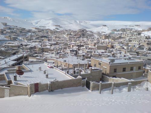
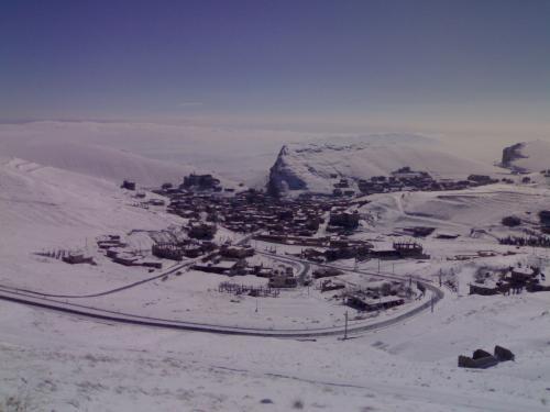
One of the oldest Syrian towns it's people still speak the Aramaic language of Jesus Christ (and also in 2 other surrounding villages). All people in Jabadeen are Muslim.
Its borders goes up to Lebanon which is a sign how strong it was to control all this area, it is the water source for most of the surrounding villages and city,
it has an amazing weather, sights and ancient tombs
Its borders goes up to Lebanon which is a sign how strong it was to control all this area, it is the water source for most of the surrounding villages and city,
it has an amazing weather, sights and ancient tombs
Nearby cities:
Coordinates: 33°49'13"N 36°30'42"E
- Tomb of the Unknown Soldier 41 km
- Convent of St Joseph - Sanctuary of St Rafka 87 km
- Qabr Umm Marzuqah 93 km
- Royal Tombs 284 km
- Shaykh Hilal 297 km
- Shaykh Hasan Cemetery 363 km
- Süleyman Şah Tomb's new place 370 km
- Tomb of Abu Badran 417 km
- Prophet Jonah Shrine (destroyed) 667 km
- Uşaklı Höyük 680 km
- Air Defense Base 1.4 km
- Mount Snir 4.8 km
- Army Base - Brigade 14 5.4 km
- Ma'loula Subdistrict 6.2 km
- Rankous Subdistrict 14 km
- Al-Qutayfah Subdistrict (Nahiyah) 15 km
- Assal al-Ward Subdistrict (Nahiyah) 16 km
- Yabroud Subdistrict 16 km
- al-Ruhaibah Valley 19 km
- al-Qalamoun Mountains/Northern Anti-Lebanon 27 km