Karaburun Peninsula
| national park
Albania /
Vlore /
Orikum /
World
/ Albania
/ Vlore
/ Orikum
peninsula, invisible, national park


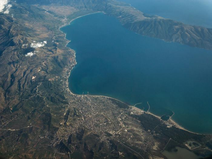
Karaburun Peninsula (Albanian: Gadishulli i Karaburunit) is the largest peninsula of Albania, located in the District of Vlorë, southwestern Albania, at the eastern side of the Strait of Otranto, where the Adriatic Sea meets the Ionian Sea. It has an area of 62 km2 (24 sq mi) and has no population. It is 16 kilometres (9.9 mi) long with a width that varies from 3 to 4.5 kilometres (1.9 to 2.8 mi). The peninsula is a Managed Nature Reserve while its sorrounding sea waters form part of the Karaburun-Sazan National Marine Park.
Karaburun = Black nose (from Turkish).
Karaburun = Black nose (from Turkish).
Wikipedia article: http://en.wikipedia.org/wiki/Karaburun_Peninsula_(Albania)
Nearby cities:
Coordinates: 40°21'22"N 19°21'32"E
- Peloponnese 272 km
- Sithonia peninsula 359 km
- Mount Athos (Agion Oros) 393 km
- Gallipoli Peninsula 577 km
- Erdek District & Kapıdağ Peninsula 696 km
- Dilek Peninsula National Park 723 km
- Bodrum 769 km
- Karpass Peninsula 1371 km
- Buri Penninsula 3404 km
- Disputed Oil Rich Bakassi Peninsula 4115 km
- Dafina Bay 0.7 km
- Pllaja e Ravenës 3.3 km
- Pier 4.4 km
- Bear's Bay - Gjiri i Ariut 4.5 km
- Air defense items 4.6 km
- 4 Whiskey class Soviet Submarines 6 km
- Partially submerged T-43 minesweeper 6.2 km
- Pasha Liman Base 6.2 km
- Bay of Vlorë 7.4 km
- Strait of Otranto 39 km