Site of Weardale Manor
United Kingdom /
England /
Westerham /
World
/ United Kingdom
/ England
/ Westerham
hill, interesting place
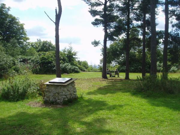
In 1906 Philip Stanhope, 1st Baron Weardale, built a substantial house here - the highest point on the greensand ridge north of the weald. From this high vantage point four counties can be seem. Little is known of the house other than it had 145 rooms and contained a magnificent 12ft wide mahogany staircase. It was only used in the summer months. After his death the house quickly fell into disrepair and by 1939 was a derelict ruin. The house was demolished at the start of WW2 as it was belived that it would be a navigational aid for any German bombers wishing to target Chartwell, the residence of the Winston Churchill, which was directly west of the house, less than 1 mile distant. The foundations and garden terrace are still visible today.
Wikipedia article: http://en.wikipedia.org/wiki/Philip_Stanhope,_1st_Baron_Weardale
Nearby cities:
Coordinates: 51°14'46"N 0°6'4"E
- Sharpeville Hills 45 km
- Wandlebury 102 km
- Mont-Noir 191 km
- Caterpillar 203 km
- Bénerville Batterie Mt Canisy 212 km
- Koppenberg 248 km
- Sint Pietersberg 392 km
- Artifical hill Sophienhöhe 443 km
- Hürfed Halde 482 km
- Asse 732 km
- Lodges Woods 1.7 km
- Henden Manor Farm 2 km
- Bough Beech Reservoir. 4.3 km
- Hever Golf Club 5.9 km
- Kent and Surrey Golf and Country Club 6.4 km
- Park Wood Golf Course 6.9 km
- Titsey Place 7.1 km
- London Borough of Bromley 14 km
- London Borough of Croydon 17 km
- Kent 45 km