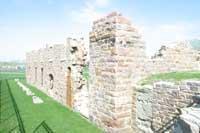
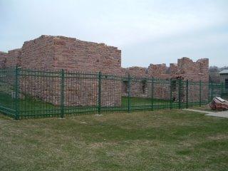
The Queen Bee Mill Ruin (Sioux Falls, South Dakota)
USA /
South Dakota /
Sioux Falls /
Sioux Falls, South Dakota
World
/ USA
/ South Dakota
/ Sioux Falls
World / United States / South Dakota
park, ruins, mill, interesting place
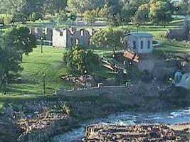
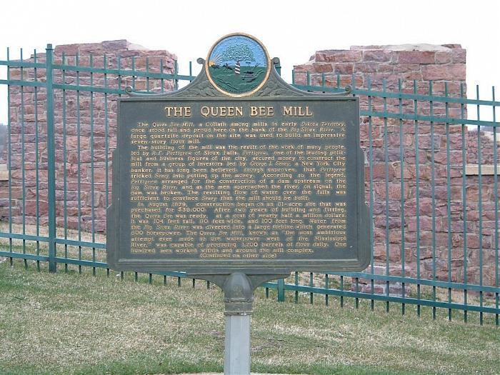
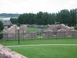
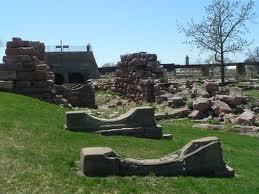
The Queen Bee Mill was built in 1879. When completed it was seven stories - 104 feet - tall, 80 feet wide, and 100 feet long. Water from the Big Sioux River was diverted into a large turbine which generated 800 horsepower. The Queen Bee Mill, known as "the most ambitious attempt ever made to use waterpower west of the Mississippi River," was capable of producing 1,200 barrels of flour daily, and employed a hundred men.
It is believed that there was some fraud and deceit involved in obtaining funding for the project; prior to a visit by potential investors, the developers arranged for a dam to be built upstream, and then blown up to create the illusion that the river could support such an ambitious project.
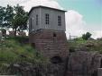
The river did not have sufficient flow to support a mill the size that was proposed, and the business slowly foundered and went bankrupt by 1883. The main building changed hands several times, but remained in use as a mill until after World War I. It was used as a warehouse until fire destroyed the building in January, 1956, leaving behind only what we see on the site today.
siouxfallshistoricsites.blogspot.com/2006/04/queen-bee-...
It is believed that there was some fraud and deceit involved in obtaining funding for the project; prior to a visit by potential investors, the developers arranged for a dam to be built upstream, and then blown up to create the illusion that the river could support such an ambitious project.
The river did not have sufficient flow to support a mill the size that was proposed, and the business slowly foundered and went bankrupt by 1883. The main building changed hands several times, but remained in use as a mill until after World War I. It was used as a warehouse until fire destroyed the building in January, 1956, leaving behind only what we see on the site today.
siouxfallshistoricsites.blogspot.com/2006/04/queen-bee-...
Nearby cities:
Coordinates: 43°33'21"N 96°43'19"W
- Lake Alvin Recreation Area 14 km
- Lake Vermillion Recreation Area 38 km
- Blue Mounds State Park 45 km
- Split Rock Creek State Park 49 km
- Lake Sarah 101 km
- Lake Shetek State Park 103 km
- Garvin County Park 111 km
- Camden State Park 111 km
- Pelican Lake Recreation Area 150 km
- Lac qui Parle State Park 177 km
- Downtown Sioux Falls 0.9 km
- Whittier Neighborhood 1.3 km
- Axtell Park Neighbourhood 1.9 km
- North Industrial Area 2.2 km
- Norton Acres 2.8 km
- Elmwood Golf Course 3.4 km
- Joe Foss Field / Sioux Falls Regional Airport (FSD/KFSD) 3.4 km
- W. H. Lyon Fairgrounds 3.9 km
- Old Orchard Area 4.7 km
- Minnehaha Country Club 4.8 km