Saint Margaret's Loch (Edinburgh)
United Kingdom /
Scotland /
Seafield /
Edinburgh
World
/ United Kingdom
/ Scotland
/ Seafield
World / United Kingdom / Scotland
reservoir, nature conservation park / area
Saint Margaret's Loch is a shallow man-made lake.
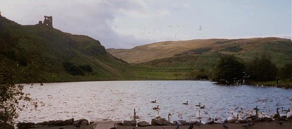
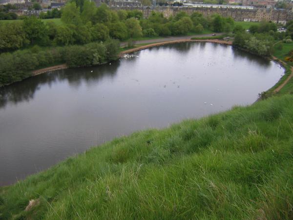
Once a boggy, marshland, the loch was formed in 1856 as part of Prince Albert's improvement plans for the area surrounding the palace. The lake was once used as a boating pond, but is now home to a population of ducks, geese, and swans.
Once a boggy, marshland, the loch was formed in 1856 as part of Prince Albert's improvement plans for the area surrounding the palace. The lake was once used as a boating pond, but is now home to a population of ducks, geese, and swans.
Nearby cities:
Coordinates: 55°57'8"N 3°9'40"W
- Glen Finglas Reservoir 85 km
- Loch Mullardoch 197 km
- Fjallsárlón 1159 km
- Kelduárlón Reservoir 1188 km
- Hálslón 1217 km
- Sigöldulón 1268 km
- Sporðöldulón 1279 km
- Bjarnalón 1290 km
- Sultartangalón 1291 km
- Blöndulón 1365 km
- Holyrood Park 0.7 km
- South Leith 2.3 km
- Portobello 2.8 km
- Port o' Leith 3.5 km
- City of Edinburgh Council 8.2 km
- Midlothian Council 14 km
- Dun Law Wind Farm 26 km
- East Lothian Council 27 km
- Toddleburn Wind Farm 27 km
- Scottish Borders 53 km