Mabalacat
Philippines /
Central Luzon /
Mabalacat /
World
/ Philippines
/ Central Luzon
/ Mabalacat
city, third-level administrative division
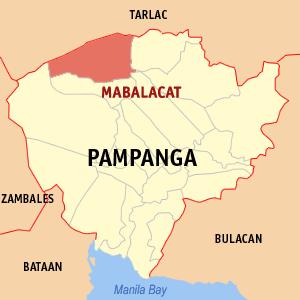
Mabalacat City, Province of Pampanga
ZIP code: 2010
Mabalacat is a landlocked component city in the northern tip of the province of Pampanga in the Philippines. It had a population of 215,610 people as registered in the 2010 Census.
Before 1712, Mabalacat was a barrio (barangay) of Bambang (now Bamban, Tarlac). The town's name is derived from the ancient "balacat" trees which were found abundantly in the area.
Mabalacat is administratively subdivided into 27 barangays:
-Atlu-Bola
-Bical
-Bundagul
-Cacutud
-Calumpang
-Camachiles
-Dapdap
-Dau
-Dolores
-Duquit
-Lakandula
-Mabiga
-Macapagal Village
-Mamatitang
-Mangalit
-Marcos Village
-Mawaque
-Paralayunan
-Poblacion
-San Francisco
-San Joaquin
-Santa Ines
-Santa Maria
-Santo Rosario
-Sapang Balen
-Sapang Biabas
-Tabun
Official Website: mabalacatcity.gov.ph/
Wikipedia article: https://en.wikipedia.org/wiki/Mabalacat
Nearby cities:
Coordinates: 15°13'5"N 120°32'12"E
- Capas 39 km
- Subic 49 km
- San Jose 54 km
- Botolan 61 km
- Mangatarem 82 km
- Candelaria 87 km
- Santa Cruz 102 km
- Mabini 126 km
- Bokod 154 km
- Kayapa 157 km
- Clark International Speedway 1.1 km
- Clark Freeport Zone 1.9 km
- Nayong Pilipino sa Clark and CAB Elephant Cage 1.9 km
- ORCHIDS WORLD 1.9 km
- Paradise Ranch Nature Park & Wildlife Sanctuary 2.2 km
- Green Canyon Resort Philippines 2.6 km
- Clark Golf Course 3.9 km
- Mimosa Plus Leisure City 3.9 km
- Clark International Airport (CRK/RPLC) 4.1 km
- New Clark City 10 km
Comments